Waze only provides driving navigation, whereas Google Maps allows you to navigate while walking, riding, biking, or taking public transportation.
As we know, Google Maps is a widely used web mapping platform that offers a bunch of features and services, including street maps, satellite imagery, aerial photography, route planning, 360° interactive panoramic view, points of interest, and more.
However, many users have recently raised concerns about its accuracy in remote locations and the need for offline navigation and live construction alerts.
To overcome these limitations, you can try the top 10 Google Maps alternatives that are discussed in this article. This will give you a different navigation experience and let you explore various amazing features.
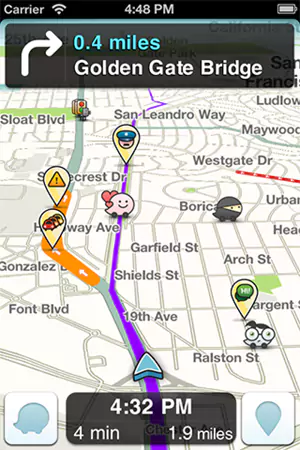
Waze is an amazing navigation platform that provides up-to-date information on accidents, road conditions, and traffic alerts to make traveling easier and less time-consuming. It also displays the cheapest gasoline prices along your route. With Waze Map Editor, you can also customize your map of any area. However, the platform is owned by Google, so you may see similar ads on Google as per your searches in Waze.
Pricing: Waze is available for free to use for Android, iOS, Mac, and PC.
Get the App: Google Play Store and App Store
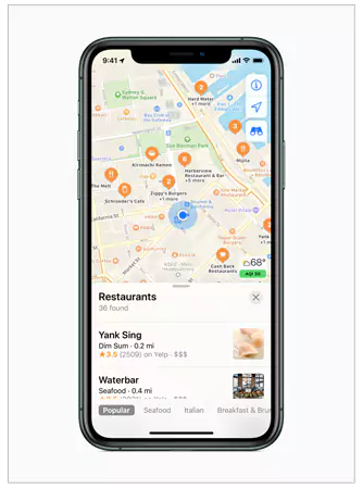
One of the best alternatives to Google Maps, Apple Maps is exclusively designed for the iOS ecosystem to enjoy location-based services, map data, and navigation. It provides a highly secure and efficient user experience with an intuitive design. You can explore turn-by-turn navigation, transit information, and the Look Around feature to see street-level views.
Pricing: Apple Maps is pre-installed on Apple devices, with no separate cost.
Get the App: App Store
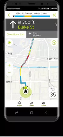
MapQuest is a popular GPS navigation app that provides real-time traffic and road condition updates, as well as distance and alternate routes. You can also check the nearby gas stations, roadside assistance, and estimated fuel costs to cover a distance.
Pricing: MapQuest is available for free with ads, while the ad-free version includes subscription charges that you can check on its official website.
Get the App: Google Play Store and App Store
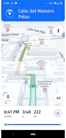
HERE WeGo is a reliable navigation app that allows you to save spots, add extra halts in a route, and do many other things. With its amazing ‘Places’ option, you can explore nearby restaurants, theme parks, gas stations, pharmacies, ATMs, hotels, and much more. Also, it helps you find parking destinations while commuting to a new location. HERE WeGo is among the top map apps for Android and iOS both.
Pricing: HERE WeGo can be used for free with some behavioral ads just like Google Maps.
Get the App: Google Play Store and App Store
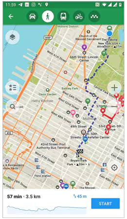
Maps.me is an open-source mobile-only service that covers all the countries in the world. You can share your location with friends and even bookmark them. The tool complies with GDPR rules and regulations and offers useful features like public transport, traffic updates, cycling navigation, and others.
Pricing: Maps.me is a free software that includes ads.
Get the App: Google Play Store and App Store
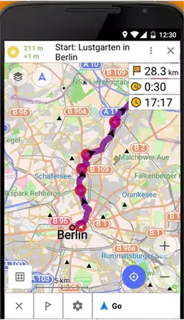
OsmAnd is a great alternative to Google Maps because it supports offline navigation and can be accessed from remote locations. However, the free version supports offline access to 7 maps only. To get more features and unlimited map downloading, you can opt for its premium plan.
Pricing: OsmAnd app can be accessed for free, but you can buy any of the three subscription plans that cost $9.99, $29.99, and $39.99 to get more features.
Get the App: Google Play Store and App Store
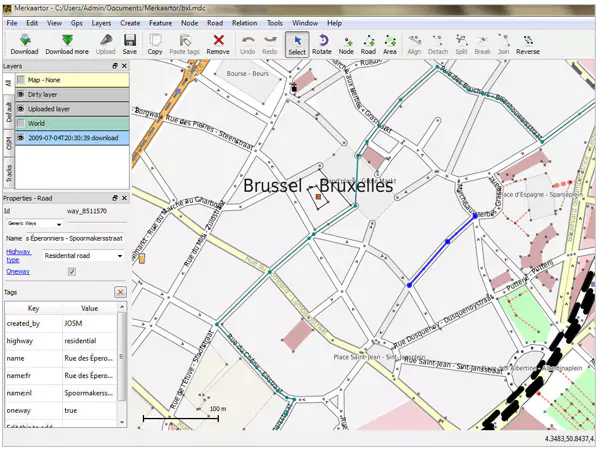
OpenStreetMap is a collaborative mapping project that offers community-driven updates and contributions. It collects data from ground surveys, GPS units, cameras, and other reliable sources. Several other apps also use OSM data to provide precise information about roads, landmarks, traffic, and points of interest. The service follows GDPR rules and regulations, ensuring your data’s security.
Pricing: OpenStreetMap is a free-to-use service with some decent features.
Get the App: No dedicated application is available.
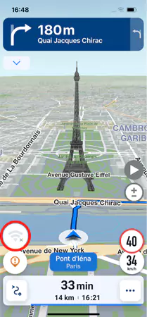
Sygic Maps is another popular free GPS navigation tool that has various features like offline search, traffic updates, voice-guided navigation, points of interest, etc. It provides easy integration with the car connectivity system and also provides parking spot suggestions, lane guidance, and speed limit alerts. However, some of these features are restricted to premium plans.
Pricing: Sygic Maps is free software with an optional premium plan that costs €14.99 for a 6-month plan and €17.99 for an annual plan.
Get the App: Google Play Store and App Store
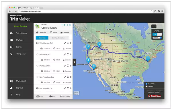
Rand McNally is a simple, straightforward navigation platform with detailed, traditional style maps. This free tool allows you to save your favorite locations for easy accessibility. However, the software only works on the web because there is no dedicated mobile app yet.
Pricing: Rand McNally lets you navigate at zero cost.
Get the App: No dedicated app is available.
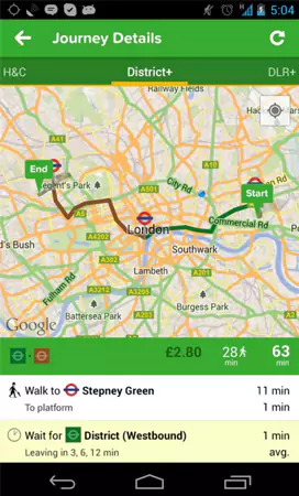
CityMapper is a trustworthy alternative to Google Maps that is highly suitable for public transport commuters. It provides navigation through the subway, tram, bus, and other transit options available in the region. CityMapper is considered a favorable app to plan itineraries incorporating walking, cycling, and public transit options.
Pricing: CityMapper is a free-of-cost platform.
Get the App: Google Play Store and App Store
If Google Maps is such a popular and advanced app, what are the reasons to look for alternatives? Unfortunately, the platform still has several limitations that compromise its functionality and user experience. They include the following:
To provide a personalized experience, Google saves your location history and search data for 18 months, which raises privacy concerns. Also, as per this data, Google suggests paid ads and locations, which can be annoying sometimes.
Sometimes the map faces issues while navigating an intricate urban landscape. This makes it difficult to find the destinations and creates unnecessary delays.
In remote locations, it is difficult to find a traditional landmark, due to which the map does not show accurate results.
The platform does not provide real-time construction alerts or track field reps and drivers, making it a less efficient navigation tool for logistics companies. This shows poor route planning and monitoring of delivery progress.
Google Maps does not offer seamless navigation and searching in an offline environment. Hence, you can’t get real-time updates for route optimization and traffic status with poor or no internet connection.
Google Maps is also not a preferable option for planning outdoor activities like hiking, biking, or running.
With the mapping services discussed above, you can easily eliminate these drawbacks while also enjoying other cool features.
We explored some of the most popular and preferable Google Maps alternatives that are available for free on Android, iOS, and PC. They offer a variety of features, including route planning, live traffic alerts, offline navigation, high data security, and much more.
Let’s switch from Google Maps and try other platforms for better mapping services.
Waze only provides driving navigation, whereas Google Maps allows you to navigate while walking, riding, biking, or taking public transportation.
Yes, you can try NASA Worldview, Bing Maps, OpenStreetMap, and HERE WeGo to get a better satellite view.
Some amazing alternatives to MapQuest are Waze, HERE WeGo, Sygic, Route4Me, Pocket Earth, and others.
You can opt for RouteXL instead of Google Maps for free route planning.